Contact: Office du Tourisme de Grimentz
Rue du Village 6
CH-3961 Grimentz
Phone +41 27 476 17 00GPS: lat 46.131981 long 7.570771
Tap to launch Maps (connection required)
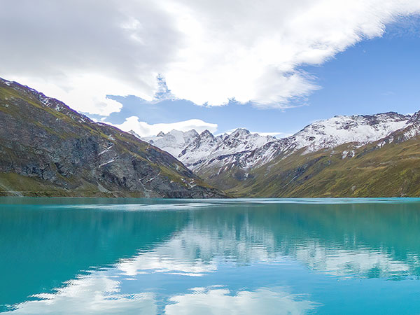
or type the coordinates in your GPS device. Built between 1954 and 1958 above Grimentz, the Moiry dam created the lake of the same name, which has become a popular tourist attraction during the summer months.
You can get there by car along a fairly narrow tarmac road, but it's much more fun and less stressful to get there by post bus from Grimentz. The bus stops just beside the restaurant next to the crown of the dam.
The dam is 148 metres high, at an altitude of 2,249 metres, with a crest 610 metres long. With a surface area of 1.4 km2, Lac de Moiry contains 77 million m3 of water.
Located 8km from Grimentz, the Moiry dam is only accessible in summer, when weather conditions allow the road to be opened. However, it is possible to get there on foot as soon as the snow melts.
The site offers a wide range of activities, including hiking around the lake or up to the glacier, via ferrata, climbing and visits of the dam. For the less adventurous, there's a simple walk along the crest of the dam.
On one side, the turquoise waters reflecting the mountains, with the Moiry glacier and impressive peaks, including the Dent Blanche (4357m), on the horizon. On the other, the Moiry valley and its breathtaking vistas... Disclaimer: Unfortunately, we cannot guarantee that this official website is optimized for iPhone and iPad! |