Contact: Grône-Loye Tourisme
Case postale 47
CH-3979 Grône
Phone +41 79 312 93 12GPS: lat 46.250908411654436 long 7.458443325276525
Tap to launch Maps (connection required)
or type the coordinates in your GPS device. The village of Grône lies on the left bank of the Rhône, between Sion and Sierre, at the foot of Mont-Noble. The municipality stretches from the plains to the mountains, with two-thirds of its land covered in forest, and also includes around ten hamlets and most of the Réchy valley.
The municipality offers a wide variety of landscapes. It includes part of the Pouta-Fontana marshes, the largest aquatic nature reserve in the canton of Valais, which form an oasis in this highly urbanised Rhône plain.
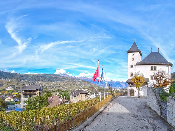
The village of Grône itself, on the plain, is notable for its Morestel Castle, built in the 16th century on the ruins of a 13th-century feudal castle, and its church, which was rebuilt in the early 20th century but whose Baroque tower dating from 1733 has been preserved.
Above the village, on the slopes of the mountain, four hamlets are built on an intermediate plateau (Itravers, Loye, Erdesson and Daillet), around 5 km from the plain. From this plateau, two roads lead to Val d'Hérens via Nax and to Val d'Anniviers via Vercorin.
The municipality's territory also includes almost the whole of the magnificent Réchy valley, a protected site that offers a wealth of hiking opportunities in exceptional Alpine scenery. Disclaimer: Unfortunately, we cannot guarantee that this official website is optimized for iPhone and iPad! |