Contact: Office de tourisme d'Argentière
24, route du Village
F-74400 Argentière
Phone +33 4 50 54 02 14GPS: lat 45.981875 long 6.926636
Tap to go to Google Maps
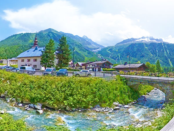
or type the coordinates in your GPS device. Argentière is a French village located in the Chamonix-Mont-Blanc region. A ski resort in the winter, it attracts many hikers in the summer, especially to walk up to the impressive glacier that bears the village's name.
The village is on the road from Chamonix to Martigny (Rhone Valley, Switzerland) via the Montets (alt. 1461m) and Forclaz (alt. 1527m) mountain passes.
The village is at an altitude of about 1250m but the glacier is much higher. It originates at around 3400m in a glacial cirque dominated by high peaks.
To see the impressive (and noisy) serac forest of its terminal tongue, you have to take a very steep path up to about 2000m.
In summer, you can also take the Plan Joran gondola lift, which takes you to 1923m, where hiking and mountain bike trails start.
In winter, this gondola provides access to the Grands Montets ski area and is not accessible to non-skiers. Disclaimer: Unfortunately, we cannot guarantee that this official website is optimized for smartphones! |